
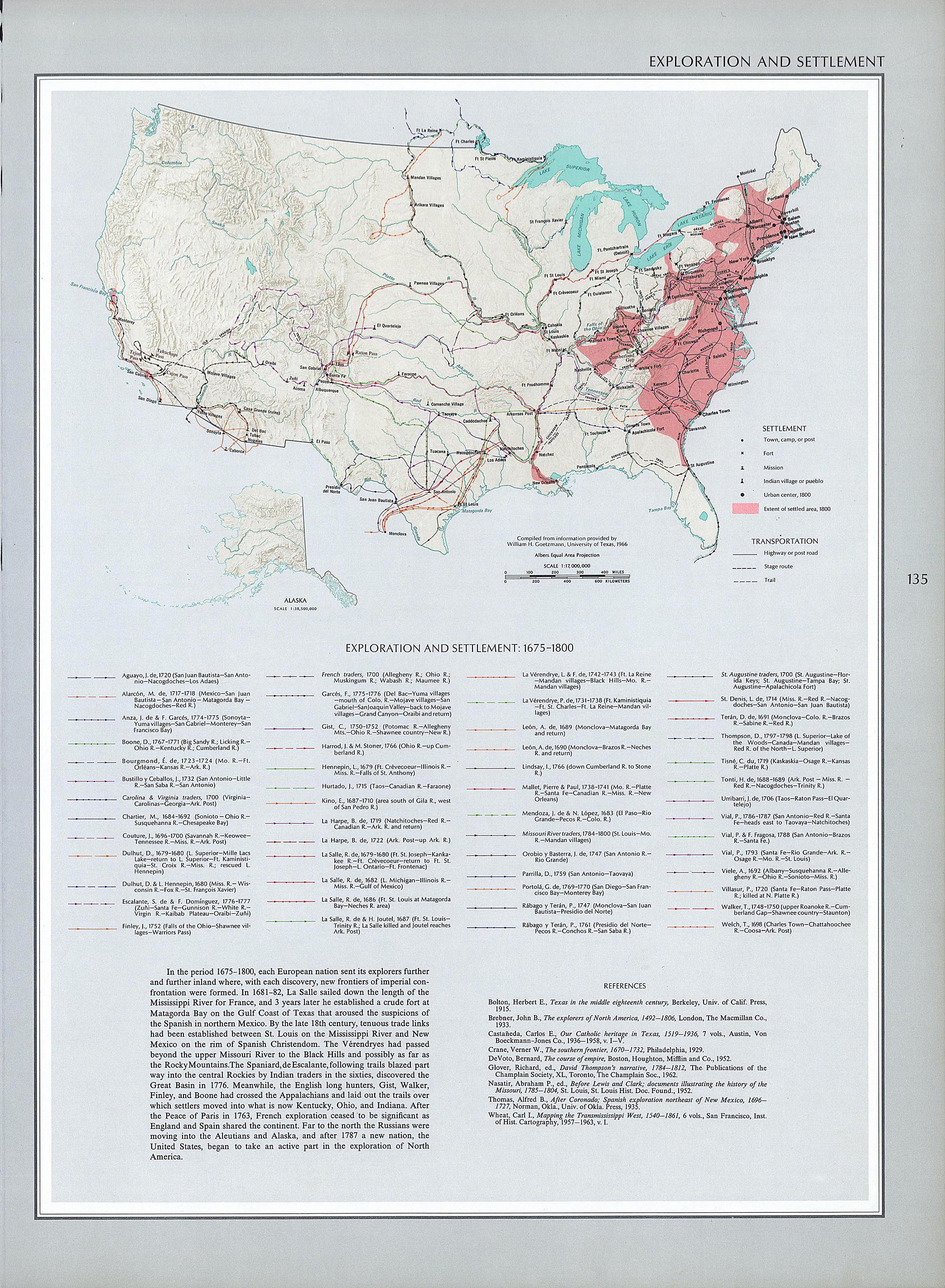
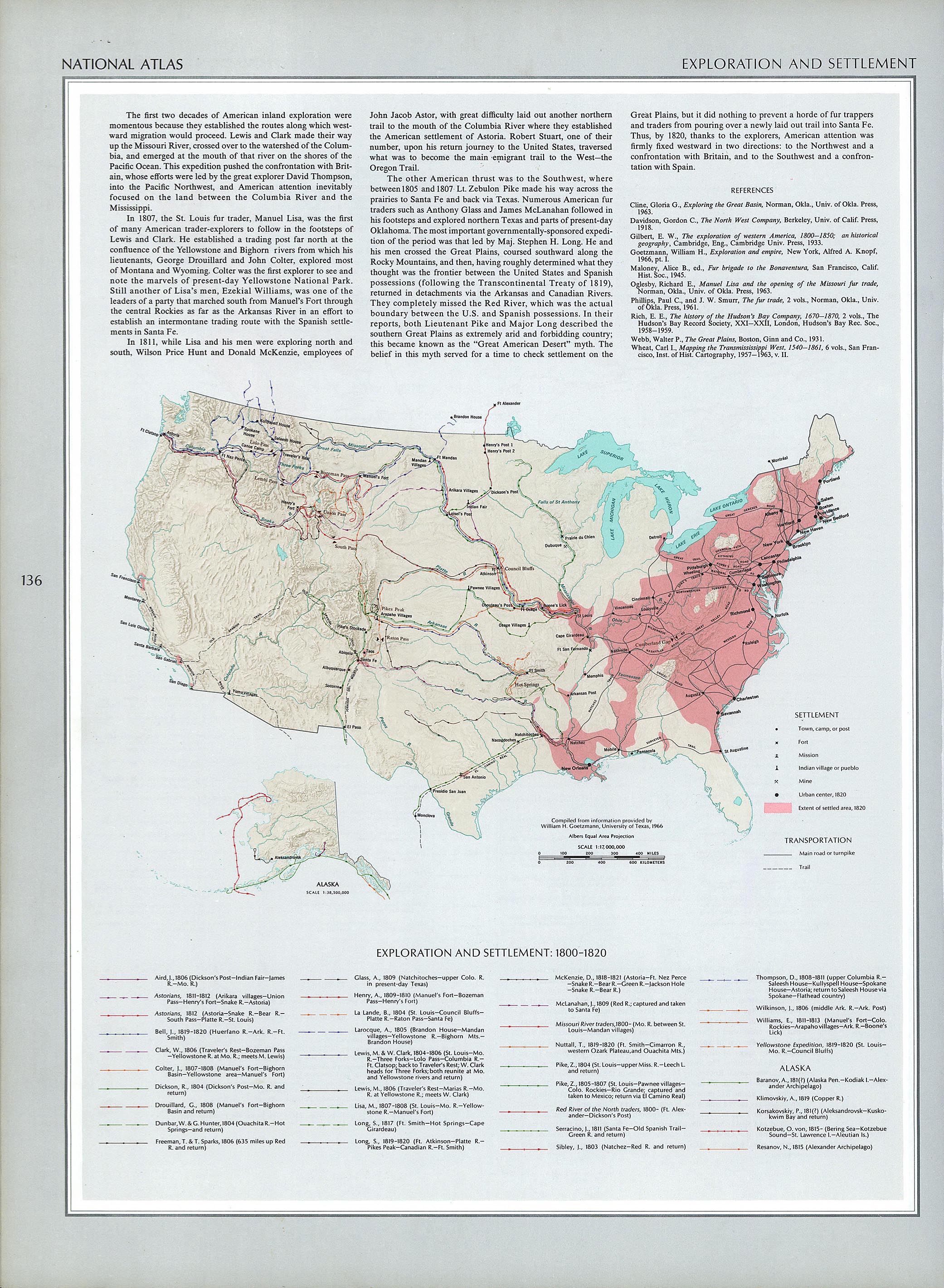
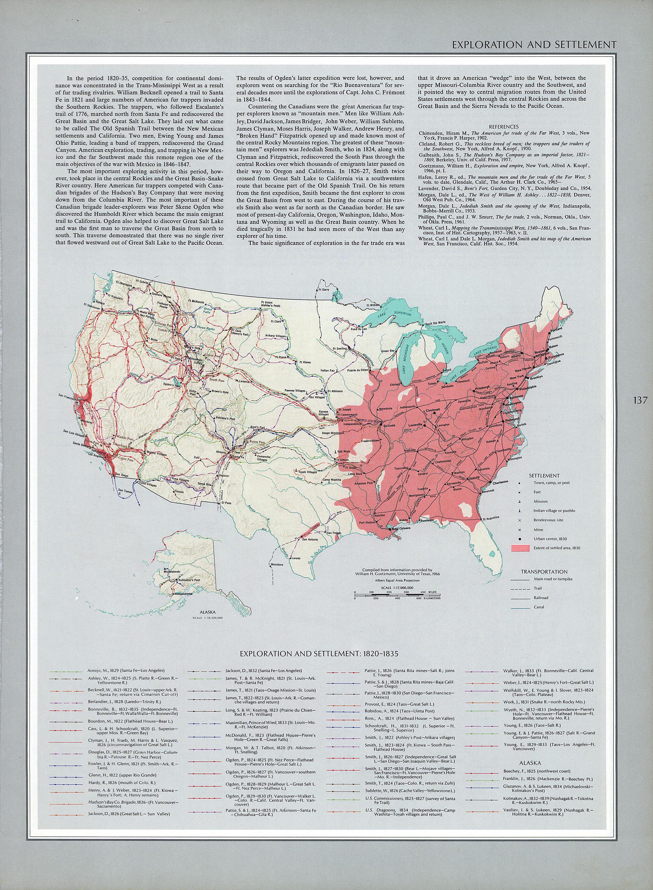
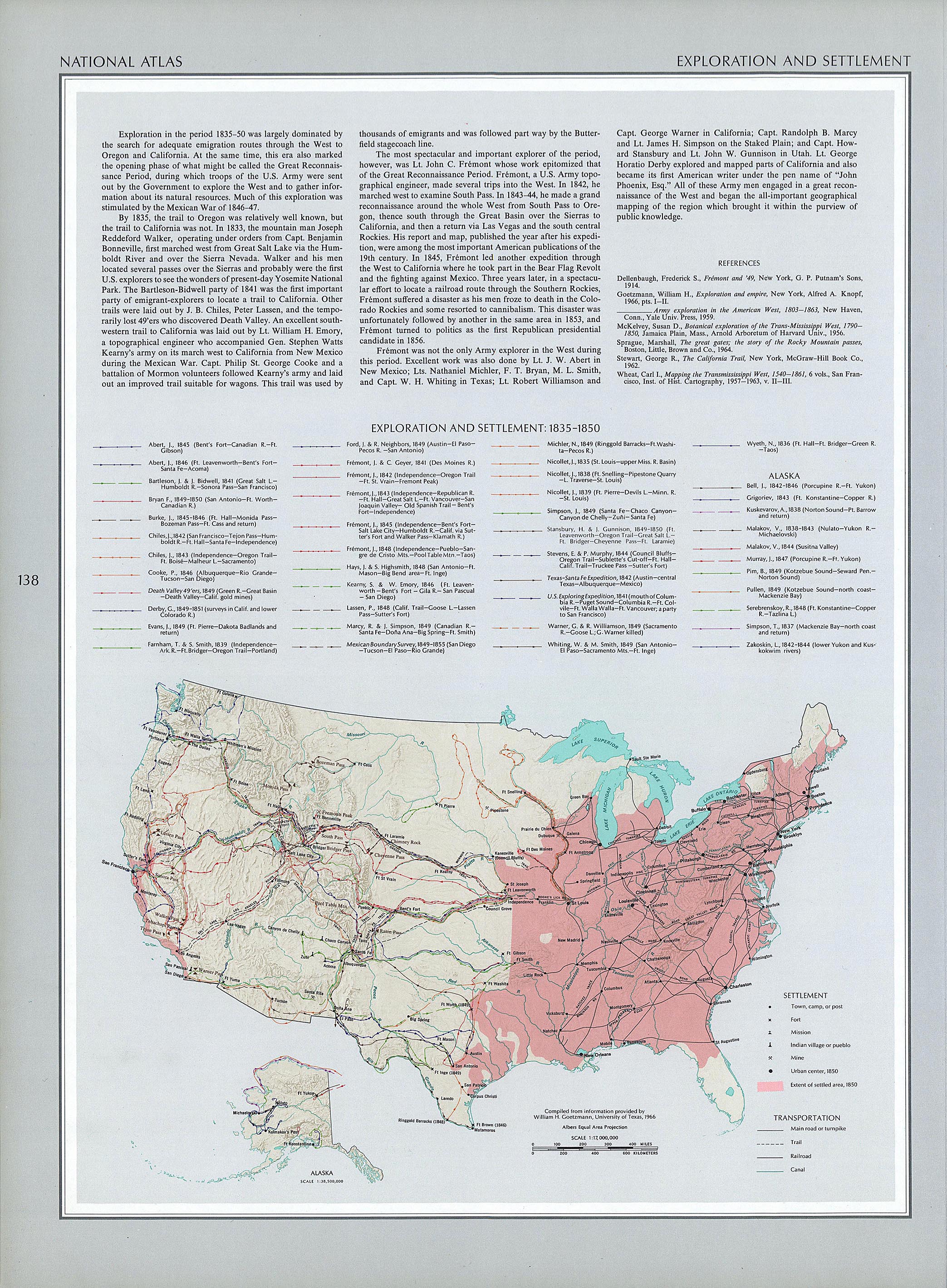
This map collection is very rich - go explore the Historical U.S. maps and see if one or more can help you understand migration trails of your ancestors. The exploration and settlement map for 1800 to 1820 is here, for 1820 to 1835 is here, for 1835 to 1850 is here, for 1850 to 1890 is here, etc.
Does anybody know where Polypotamia and Pelisipia were in the 1783 to 1803 time frame? Check out this great territorial map of the United States.
1 comment:
On the subject of maps - also keep in mind that Google Earth has a number of historical street maps which can be laid over a city or region. For example, if you happen to be looking at South Philly there are 3 or 4 different map overlays - including a 1942 land use map.
Post a Comment